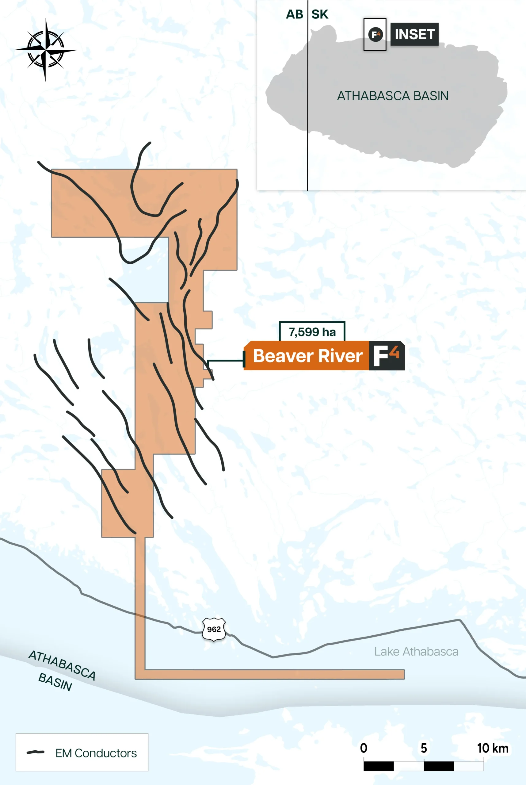
The Beaver River project, owned entirely by F4 Uranium Corp., spans 9 claims over 7,599 ha near the Athabasca Basin’s northwest edge and 40km east of Uranium City. It’s situated in the Beaverlodge Domain of the Rae Tectonic Province. The property is located 4.5km to the east of the polymetallic VIC zone.
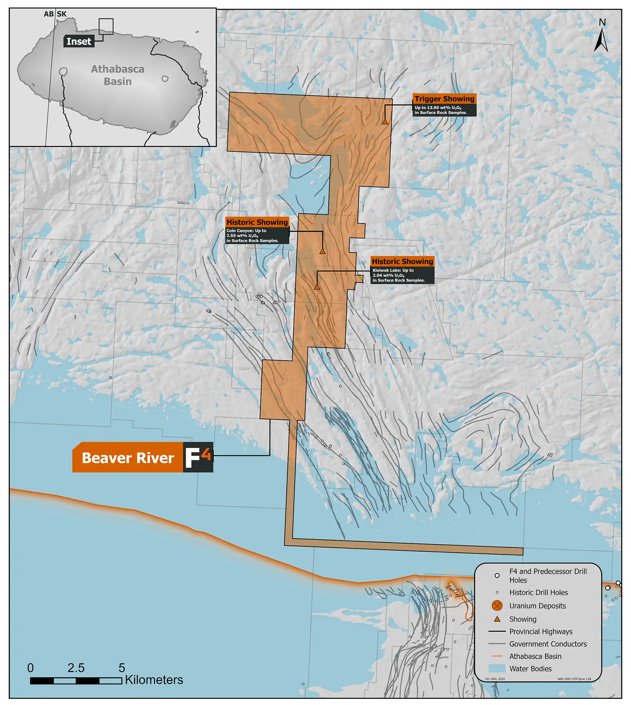
F3 Uranium Corp. commissioned a 5,200 km airborne high resolution magnetic/radiometric survey over most of the property in 2013, which was followed with an 880 km helicopter-borne VTEM Plus survey. More than 110 km of conductors are defined on the property by the VTEM survey. The interpreted results indicated complex conductor swarms with numerous areas of enhanced conductivity, as well as many areas of trend widening evidenced by an increase in parallel multiple conductors and many offsets and termination points indicative of cross structures.
Prospecting by F3 Uranium Corp. in 2019 found a new showing in the north of the Property, later named the Trigger showing, returned 13.9% U3O8 and 2.27 g/t gold from a radioactive vein on surface. Near the middle of the property, trench grab samples from Coin Canyon displayed up to 15000 CPS on a handheld scint and up to 2.55% U3O8 and from south of East Kisiwak Lake trench samples returned 2.04% U3O8. Trench chip samples collected in the nearby VIC south zone yield up to 29.89% U3O8 approximately 4.5km to the East of the Beaver River Property.
Dev Randhawa is a seasoned CEO with extensive experience in resources, mining exploration, and energy companies. As the former CEO of Fission Uranium Corp., Mr. Randhawa, along with his technical team, led the high-grade uranium discovery at PLS in 2012. Recently, Paladin Energy made an offer of $1.1 billion to buy Fission Uranium.
In 1996, Dev founded Strathmore Minerals Corp., leading it until 2008. Mr. Randhawa spun off Fission Energy Corp. in 2007, focusing on uranium exploration in Saskatchewan. He sold major assets to Denison Mines in 2013 for $85 million, creating Fission Uranium Corp.
Dev has executed significant joint ventures, including a $50 million partnership with Sumitomo (Japan) and $44mil with KEPCO (Korea). In 2016, Dev negotiated an $82 million investment in Fission from CGN Mining. He holds a BBA from Trinity Western College and an MBA from the University of British Columbia.