

East Athabasca Basin Projects
Lazy Edward Bay
key highlights
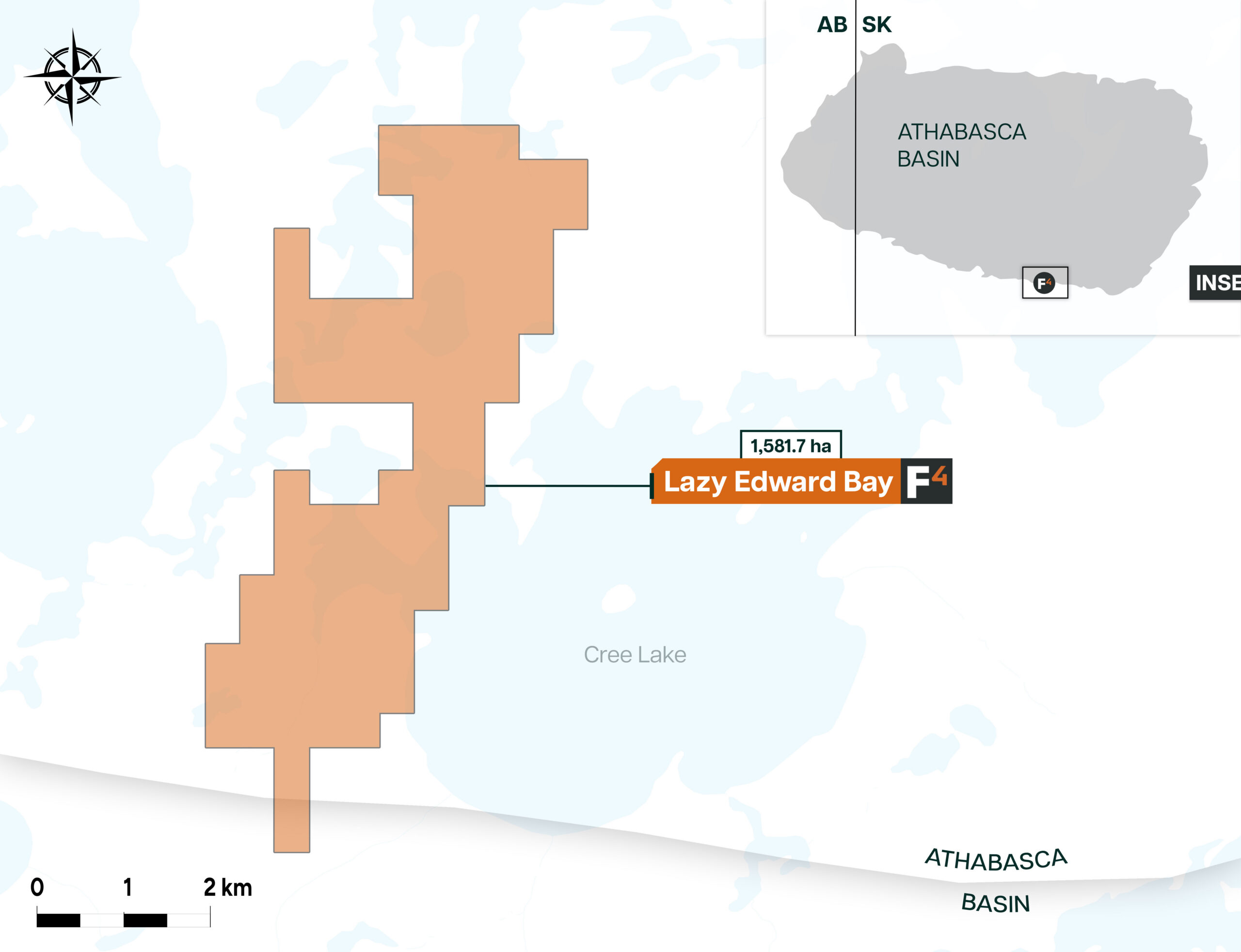
LOCATION AND ACCESS
The Lazy Edward Bay Property holds 11 mineral claims, covering 1,827.9 hectares. It is situated approximately 12.5 km east of the Cable Bay Shear Zone, in the southeastern part of the Athabasca Basin, known for its shallow sandstone cover. This geographic positioning places the property in a region of interest for uranium exploration.
GEOPHYSICS
Geophysics completed in 2017 included airbourne VTEM and Magnetic surveys over the 297 line kilometers of the property. Interpretation of the magnetic data displayed a series of north-south trending conductors. The main conductive trends on the property include the Horse conductor (previously part of the Ponderosa conductor trend) and the Liberty conductive trend. The main west portion of the property captures most of the Ponderosa conductive trend and the eastern claims of the property covers part of the Liberty conductive trend.
DRILLING
F3 completed its first drill program on the property in Summer of 2022 totaling 10 drill holes and 3005m. Drilling intersected intensely clay, hematite and limonite alteration in sandstone in multiple holes and anomalous radioactivity in five holes LEB22-004, LEB22-005, LEB22-007, LEB22-008 and LEB22-009 up to a max of 480 CPS on a handheld spectrometer (LEB22-008). Hole LEB22-004 and 005 geochemistry returned maxes of 1300 ppm and 1460 ppm boron, along with 38 ppm and 39 ppm U(TD) respectively in the sandstone just above the Unconformity with LEB22-005 also displaying 52 ppm U(TD) in the basement just below the Unconformity. Holes LEB22-007 and 008 also displayed slightly elevated Uranium values in basement just below the Unconformity with maxes of 47 ppm and 43 ppm U(TD). The highest uranium values from the program were intersected in hole LEB22-002 with a small fault at 302m returning 70ppm U(TD). Historic drill holes LE-072 encountered 170 ppm uranium in brecciated and sheared gneiss, and LE-073 with 40 ppm uranium along with 550 ppm boron within sandstone fault gouge. On the Eastern claims a nearby drill hole LE-001 intersected 224 ppm U over 0.5m.
Uranium Exploration Potential
Drilling in the summer of 2022 following up on the historic drilling on the western claims intersected further radioactivity with intense clay, hematite and limonite alteration in sandstone in multiple holes as well as significant basement structure. Geochemistry from F3’s 2022 program showed elevated Uranium and anomalous Boron in both the sandstone and basement in multiple holes highlighting the areas prospectivity for uranium exploration. The Lazy Edward Bay property is located over shallow sandstone cover approximately 12.5 km east of the Cable Bay Shear Zone, which is a major crustal-scale structure extending across the Basin in a southwest-northeast direction and similar geologically to the Wollaston-Mudjatik Transition Zone to the east. Both the Horse conductor and the Liberty conductive trend have showed promising drill results for uranium exploration which warrant further work.
maps