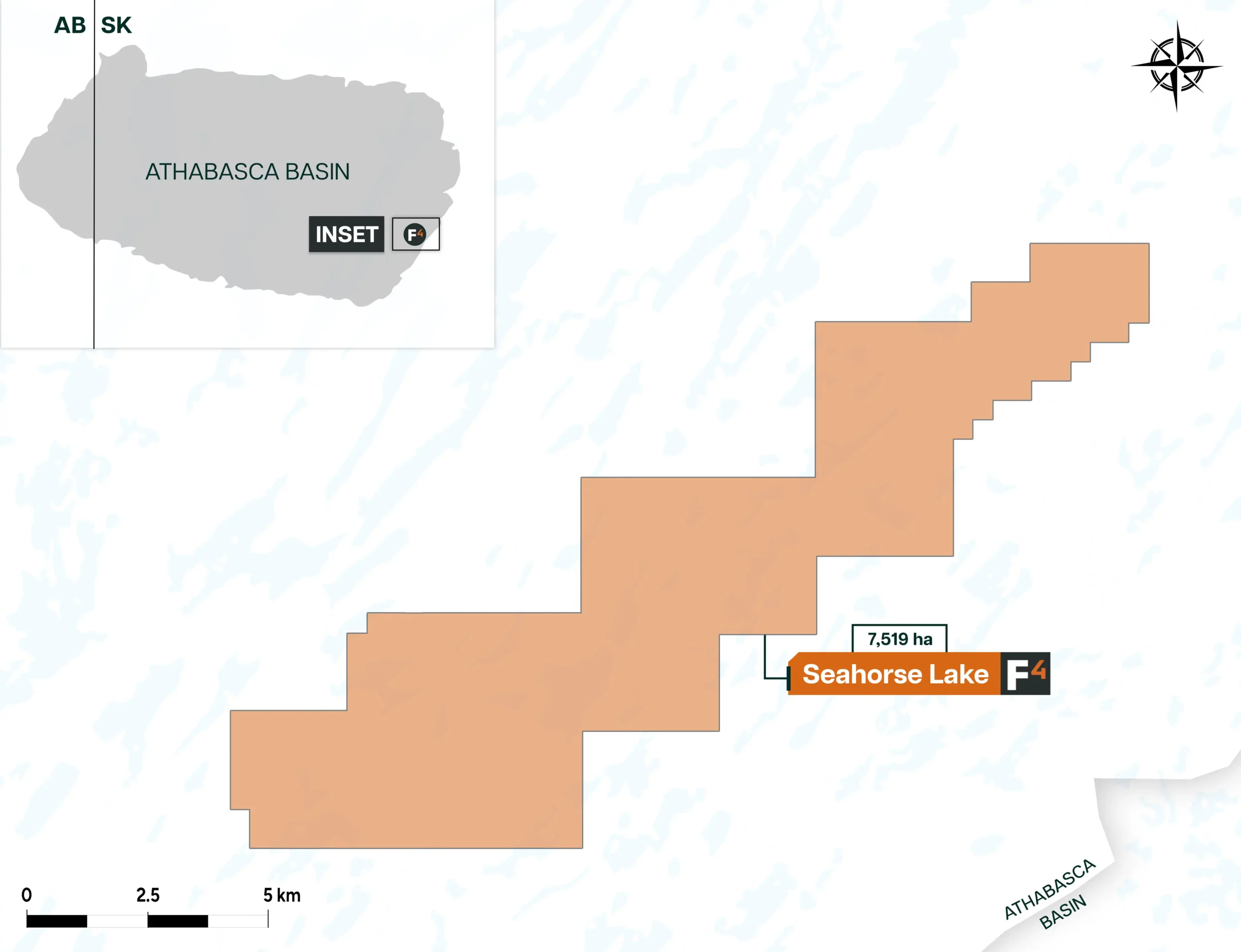
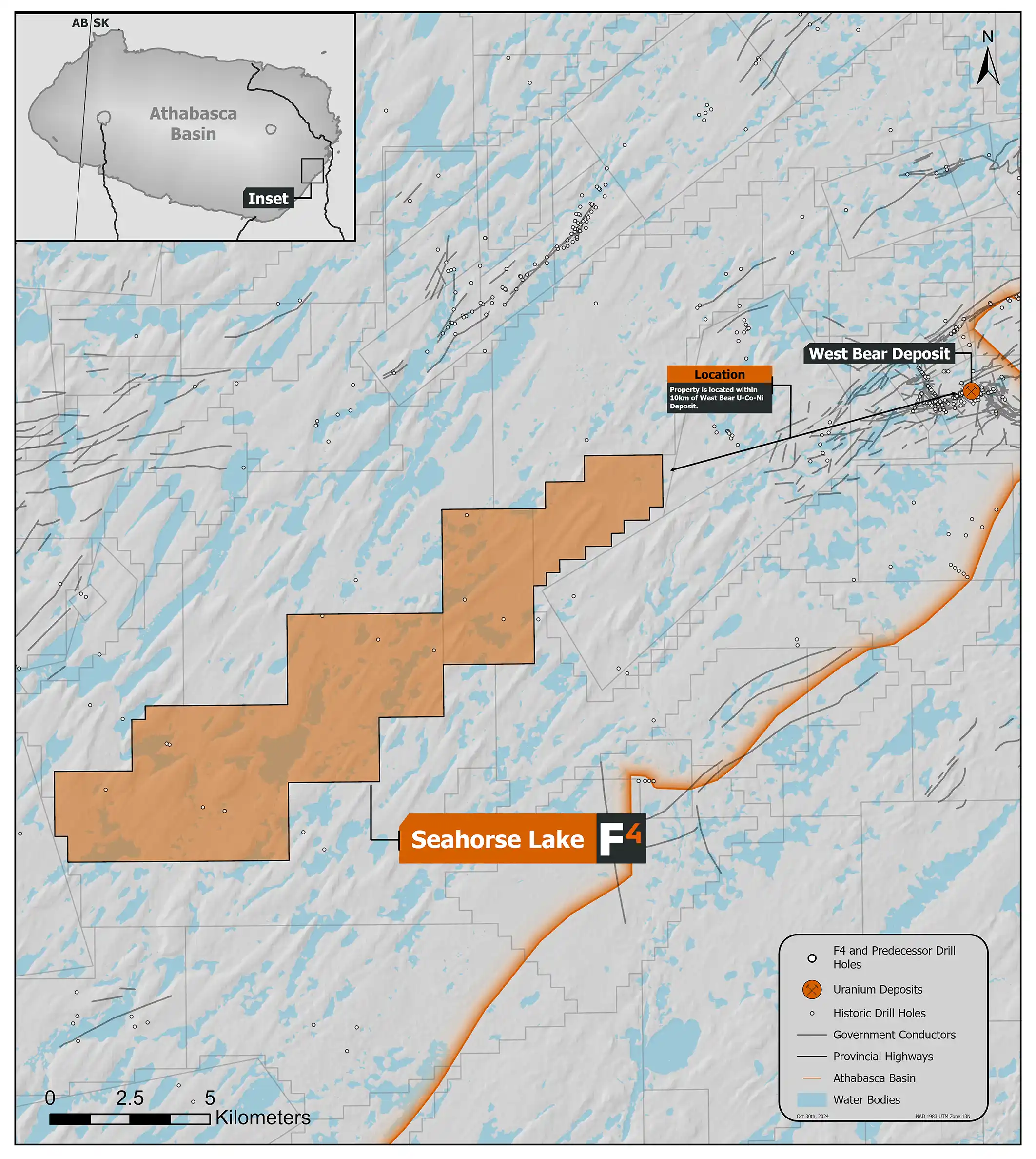
The Seahorse Lake Property comprises 3 mineral claims with an area of 7,519 ha. This property is located over shallow sandstone cover overlying the highly prospective Wollaston-Mudjatik Transition Zone of the eastern Athabasca Basin, a region known for its uranium potential. Seahorse Lake lies just 31km southeast of the Cigar Lake uranium mine and 60km south of the McClean Lake Mine site. The West Bear uranium-cobalt-nickel deposit is situated less than 7 km to the northeast.
The Seahorse Lake Property lies along trend from the conductor trend where UEX’s West Bear uranium-cobalt-nickel deposit is hosted. In 2022 F3 Uranium Corp. conducted a small ground geophysical program consisting of 17km of Time Domain EM surveys over historic airborne geophysical targets on the NE and SW corners of the property. No sub-vertical responses were detected in the two areas, but the survey only covered a small portion of the property.
In 2007 Denison drilled hole SR-05 and SR-05a on the property targeting faulting. Alteration and bleaching were intersected in the basement but both holes were lost before reaching the target due to sanding in, hypothesized to be related to the target fault. Historic drilling on the property by Noranda Exploration Company and AGIP Canada yielded so significant results but noted bleaching and illite clays within the sandstone and strong hematite alteration in the basement.
Dev Randhawa is a seasoned CEO with extensive experience in resources, mining exploration, and energy companies. As the former CEO of Fission Uranium Corp., Mr. Randhawa, along with his technical team, led the high-grade uranium discovery at PLS in 2012. Recently, Paladin Energy made an offer of $1.1 billion to buy Fission Uranium.
In 1996, Dev founded Strathmore Minerals Corp., leading it until 2008. Mr. Randhawa spun off Fission Energy Corp. in 2007, focusing on uranium exploration in Saskatchewan. He sold major assets to Denison Mines in 2013 for $85 million, creating Fission Uranium Corp.
Dev has executed significant joint ventures, including a $50 million partnership with Sumitomo (Japan) and $44mil with KEPCO (Korea). In 2016, Dev negotiated an $82 million investment in Fission from CGN Mining. He holds a BBA from Trinity Western College and an MBA from the University of British Columbia.