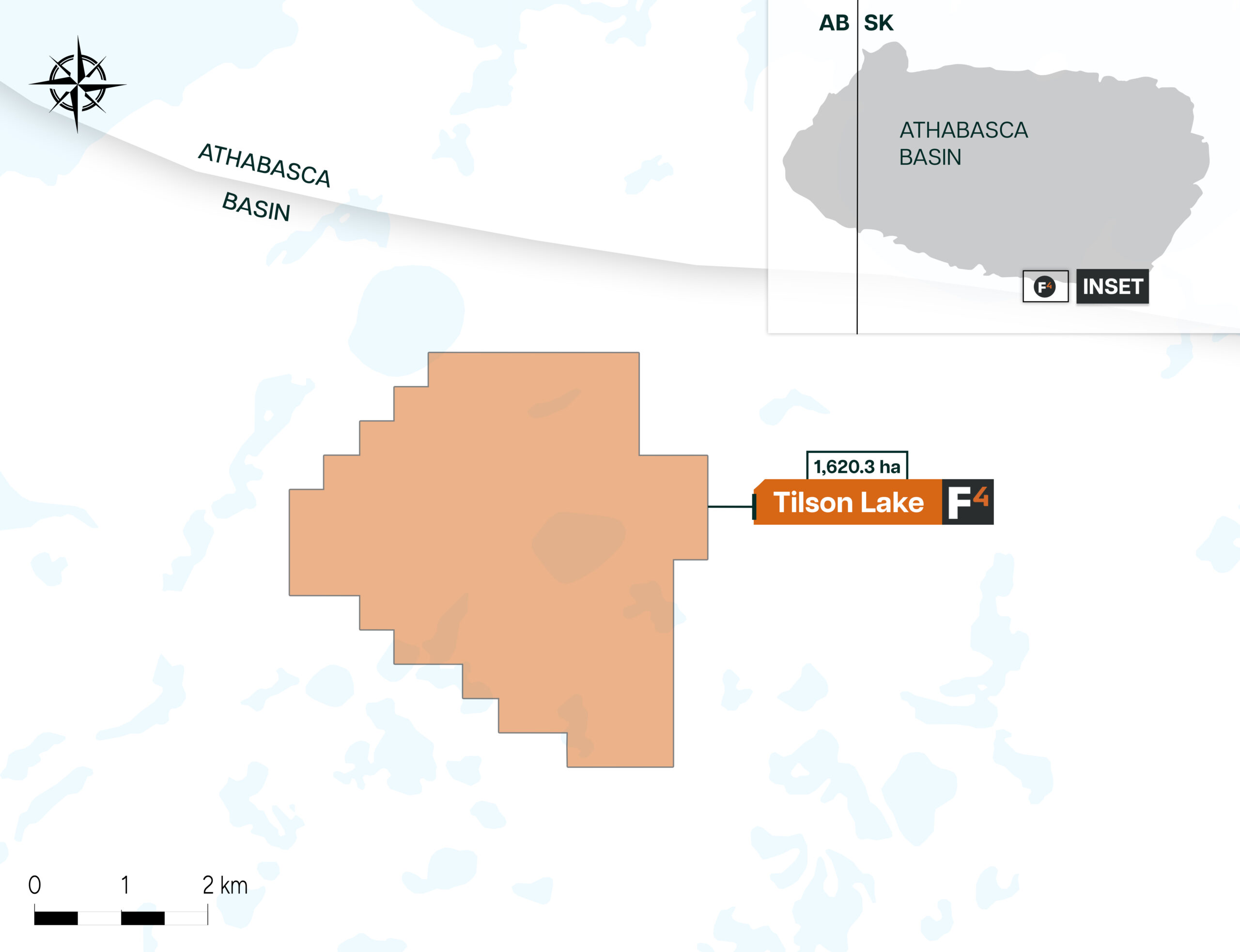

The Tilson Lake Property consists of 5 mineral claims, covering 1,620.3 hectares located just 2km south of the prospective Lazy Edwards Bay property. It is situated approximately 12.5 km east of the Cable Bay Shear Zone, in the southeastern part of the Athabasca Basin, known for its shallow sandstone cover. This geographic positioning places the property in a region of interest for uranium exploration.
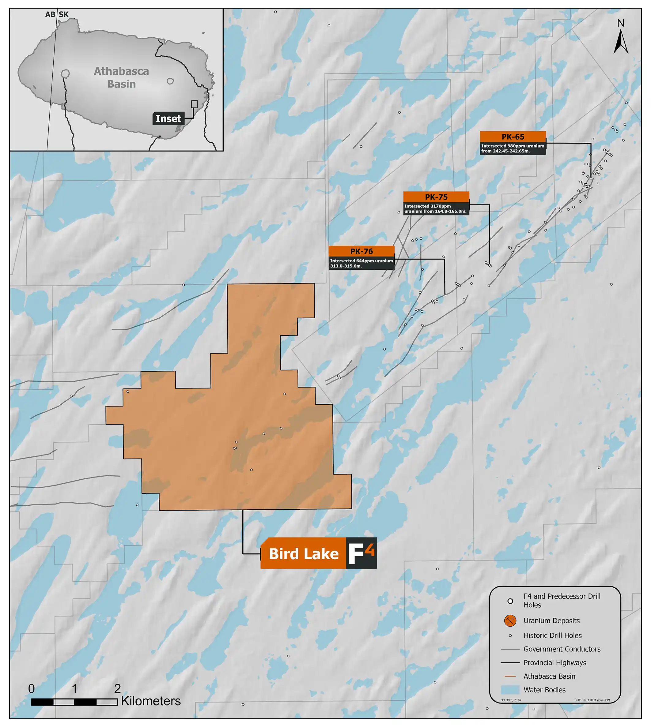
In 2022 F3 Uranium Corp. conducted a small 17km of ground DC Resistivity and Small Moving Loop Time Domain EM geophysics program over historic airborne geophysical targets on the NE and SW corners of the property. No sub-vertical conductor responses were detected.
Approximately 4km to the NE of the Bird Lake property Cameco and Denison drilled 5 holes in 2008 along the Bird Lake Fault, the best being hole PK-75 which had a max of 2680 CPS on a handheld scintillometer and 3170 ppm U at 165m. F3’s claims lie along strike of the Bird Lake Fault system. In 2015, 2 holes drilled by Denison on the property (BB-14-01 and BB-14-02) intersected intensive faulting and brecciated clay rich gouge in the basement which was interpreted to be related to the Bird Lake Fault indicating the fault system likely continues on the property despite no conductor responses being identified by recent geophysics.
Dev Randhawa is a seasoned CEO with extensive experience in resources, mining exploration, and energy companies. As the former CEO of Fission Uranium Corp., Mr. Randhawa, along with his technical team, led the high-grade uranium discovery at PLS in 2012. Recently, Paladin Energy made an offer of $1.1 billion to buy Fission Uranium.
In 1996, Dev founded Strathmore Minerals Corp., leading it until 2008. Mr. Randhawa spun off Fission Energy Corp. in 2007, focusing on uranium exploration in Saskatchewan. He sold major assets to Denison Mines in 2013 for $85 million, creating Fission Uranium Corp.
Dev has executed significant joint ventures, including a $50 million partnership with Sumitomo (Japan) and $44mil with KEPCO (Korea). In 2016, Dev negotiated an $82 million investment in Fission from CGN Mining. He holds a BBA from Trinity Western College and an MBA from the University of British Columbia.